 Trekking CougarsChoosing & Chasing Mountains
By Nishant Sagar — Trekking Cougars Client ✓ Done Kedarkantha Trek with TC · February 2022
Summit Altitude
Total Distance
Duration
Difficulty
The Kedarkantha Trek was not on my bucket list until my colleague came back from it in December 2021 and showed me a photo of the frozen Juda Ka Talab lake surrounded by snow-laden pine trees. I booked my slot the same evening. February 2022. I went with Trekking Cougars and I am still grateful I did.
I am not a professional trekker. I work in Noida, I sit at a desk for 10 hours a day, and before Kedarkantha the longest walk I had done was a 6-kilometre morning walk near my apartment. I mention this because I want whoever is reading this to know that the Kedarkantha Trek is genuinely accessible. Not easy — nothing above 10,000 feet is truly easy — but accessible. I did it. My batch had a 58-year-old retired schoolteacher from Lucknow who made it to the summit ahead of most of us. That tells you something about this trek.
This guide covers everything I wish someone had told me before I went, everything I learned on the trail, and all the verified facts you need to plan the Kedarkantha Trek properly in 2026.
Table of Contents
ToggleKedarkantha Trek — Complete Facts at a Glance
| Location | Uttarkashi District, Garhwal Himalayas, Uttarakhand — inside Govind Wildlife Sanctuary |
| Summit Altitude | 12,500 ft (3,810 m) — Kedarkantha Peak |
| Base Camp | Sankri Village — 6,400 ft (1,950 m) |
| Key Campsites | Juda Ka Talab (9,100 ft) → Kedarkantha Base Camp (11,250 ft) → Hargaon (8,900 ft) |
| Total Distance | ~20 km total trekking distance |
| Duration | 5 trekking days + 1 day drive (6 days total from Dehradun) |
| Difficulty | Easy to Moderate — first-timer friendly with basic fitness |
| Summit Views | 360° — Swargarohini, Bandarpoonch, Kala Nag (Black Peak), Ranglana, Yamunotri and Gangotri ranges |
| Best Season | Dec–Feb (snow/frozen lakes) · Apr–Jun (meadows) · Oct–Nov (autumn clarity) |
| Avoid | July–September (monsoon — slippery trails, landslide risk) |
| From Delhi | Delhi → Dehradun: 5–6 hrs · Dehradun → Sankri: 200 km, 8–9 hrs |
| Temple at Summit | Small shrine dedicated to Lord Shiva and Goddess Parvati at Kedarkantha peak |
February 2022 — What the Kedarkantha Trek Looked Like in Full Snow
I want to give you the February picture specifically because it is what most people imagine when they think of Kedarkantha — and the reality is both more beautiful and more demanding than the photos suggest.
We left Dehradun at 6 AM. The drive to Sankri is 200 kilometres and takes 8 to 9 hours — through Mussoorie, past the Kempty Falls, through the hills of Uttarkashi, winding into the Tons Valley. I slept for part of it. When I woke up somewhere past Purola, the road was lined with snow. By the time we reached Sankri at 6,400 feet that evening, there was a foot of snow on the ground and it was -4°C. February in Sankri is cold. Not dramatically cold, not survival-cold, but the kind of cold where you are grateful for every layer you packed and you wish you had packed one more.
Day 1 on the trail to Juda Ka Talab changed everything. The pine and maple forest from Sankri was buried in snow. Not dusted — buried. The trees were heavy with it, the trail was white, and except for the sound of our boots and occasional calls from birds in the canopy, the forest was completely silent. There is a specific silence that comes from snow-covered forest that I had read about in books and never actually experienced. That day was the first time. I understood it immediately.
Juda Ka Talab was frozen solid. Flat, white, completely still. The pine trees around it stood in their vertical lines above the horizontal ice and the combination — I still have the photo on my phone and I still find myself looking at it sometimes. We were told not to walk on it. I stood at the edge and looked at it for a long time.
Summit day in February means leaving camp at 4 AM in -10°C darkness with a headlamp. The snow was knee-deep on the upper sections. Three hours of climbing in that dark and cold and then — the sun came up while we were still on the ascent, and the Bandarpoonch peak caught the first light and turned from grey to orange to gold in about four minutes. I stopped climbing and just stood there. Someone behind me nearly walked into me. I didn’t care.
At the Kedarkantha summit at 12,500 feet, standing in front of the small Shiva temple with the entire Garhwal range in a 360-degree arc around me — that was when I understood why people keep coming back to the mountains. Not because of any single dramatic moment. Because of the accumulation of small ones that add up to something larger than you can hold.
What Makes the Kedarkantha Trek Different from Every Other Beginner Trek
The Kedarkantha Trek is often called the “Queen of Winter Treks” and that reputation is earned. But what specifically makes it different — not just from a marketing angle, but actually, on the trail?
The summit is a real summit. Most beginner treks take you to a viewpoint or a lake. Kedarkantha takes you to a peak. A triangular mountain at 12,500 feet. Standing at the top with peaks in every direction and the Tons Valley visible 6,000 feet below you — that is a qualitatively different experience from standing at a ridgeline. The Kedarkantha Trek gives beginners a genuine summit moment that most other Easy-to-Moderate treks do not offer.
The forest is extraordinary. The Govind Wildlife Sanctuary that the Kedarkantha Trek passes through contains some of the finest forest walking in the Garhwal Himalayas. Dense pine, oak, maple and deodar. In winter the trees are snow-covered and silent. In spring the rhododendrons bloom. In autumn the oak and maple turn orange and red. The forest between Sankri and Juda Ka Talab is beautiful in any season.
Juda Ka Talab is something else. According to local belief, this lake was formed when Lord Shiva shook water droplets from a strand of his hair. In winter it freezes completely — flat white ice at 9,100 feet, surrounded by snow-laden pine trees. Even non-religious people find something significant about this place. It doesn’t announce itself dramatically. It just sits there, quiet, and you feel it.
The wildlife. Inside Govind Wildlife Sanctuary you are in the habitat of the Himalayan Monal — Uttarakhand’s state bird, iridescent green and blue, one of the most beautiful birds in the Himalayas. Musk deer, Himalayan black bear, Bharal (blue sheep), and in the deeper forest, snow leopard. You are unlikely to see most of these, but knowing they are in the forest around you changes how you walk through it.
Day by Day — The Kedarkantha Trek Itinerary
Day 0 — Arrive in Dehradun
Most operators, including Trekking Cougars, use Dehradun as the assembly point. Arrive the night before Day 1. Jolly Grant Airport is 30 km from Dehradun city. Dehradun railway station receives trains from Delhi, Mumbai, Chandigarh and most major cities. Sleep early — Day 1 is a long drive.
Day 1 — Drive Dehradun to Sankri (200 km / 8–9 hours) + Village Walk
Depart Dehradun by 6–7 AM. The drive takes you through Mussoorie, Kempty Falls, the Yamuna valley, through Uttarkashi district town, and then up the Tons Valley to Sankri. The road beyond Purola into the Tons Valley is where the mountains start asserting themselves. By the time you reach Sankri at 6,400 feet, the altitude is already doing something to the air.
Sankri is a small Garhwali village centred around the Someshwar Mahadev temple — a wooden-carved temple with intricate local craftsmanship worth looking at before you leave. The village has homestays, guesthouses, and a handful of small shops. Spend the evening exploring, eating a warm dinner, and sleeping by 9 PM. Your body is already at 6,400 feet and it needs the rest.
Day 2 — Sankri to Juda Ka Talab (4 km / 4–5 hours / 9,100 ft)
First day on the trail. The route from Sankri passes through the village of Saud and enters the forest almost immediately. Pine, maple, oak — dense and beautiful. The trail is gradual and well-marked. After about 3 km, the forest begins to open and the first views of the upper ridgeline appear.
Juda Ka Talab at 9,100 feet is your campsite. In winter it is frozen solid and surrounded by snow-heavy pine trees. In spring and autumn the lake is clear and the reflection of the trees in the water is one of the finer campsite views on this trek. In February, the temperature at Juda Ka Talab drops to -8 to -10°C overnight. That sounds frightening. It is manageable with proper gear. The stars from this campsite on a clear winter night are genuinely extraordinary.
Day 3 — Juda Ka Talab to Kedarkantha Base Camp (4 km / 3–4 hours / 11,250 ft)
The trail from Juda Ka Talab continues to climb through the upper forest — oak trees now, the pine thinning as you gain altitude. After about 2 km, the forest opens entirely into meadow. This is the section where on clear days you can see Kedarkantha peak directly above you, triangular and white, and it is closer than it looks. Kedarkantha Base Camp at 11,250 feet sits in a wide clearing with panoramic mountain views. Swargarohini, Bandarpoonch and Kala Nag are all visible from here. The temperature at base camp drops to -10 to -15°C in February nights. Sleep in all your layers.
Day 4 — Summit Day (12,500 ft) and Descent to Hargaon (8,900 ft)
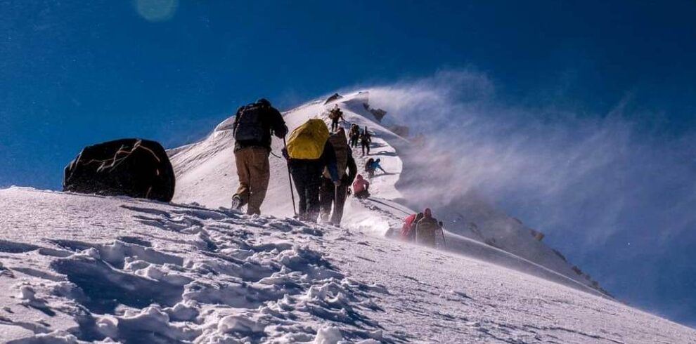
The most important day. Start at 4–5 AM with headlamps. In winter you are walking on snow from the first step — ankle-deep near base camp, knee-deep on the upper sections. The climb from base camp to the summit covers 1,250 feet of elevation gain over approximately 3 km. The trail is steep in the final section and involves zigzag switchbacks up the snowfield.
And then you are at 12,500 feet with a Shiva temple in front of you and the entire Garhwal Himalaya in every direction. Swargarohini (6,252 m) to the northeast. Bandarpoonch (6,316 m) to the north. Kala Nag / Black Peak (6,387 m) to the north. Ranglana visible further. On very clear days, peaks of the Yamunotri and Gangotri ranges are visible. The 360-degree panorama from Kedarkantha summit is the defining moment of this trek and it delivers every time.
Descent goes down a different route toward Hargaon — a wide open grassland at 8,900 feet that is snow-covered in winter and lush green in summer. Hargaon is your last campsite on the Kedarkantha Trek.
Day 5 — Hargaon to Sankri (6 km / 4–5 hours) + Drive to Dehradun
The final descent from Hargaon to Sankri follows a rocky but well-paved trail through forest, past streams, with views of the Har Ki Dun valley visible from the lower sections. Reach Sankri by mid-morning, have a hot meal, then drive back to Dehradun (8–9 hours), arriving by evening.
Base village: Sankri, 6,400 ft
Descent via Hargaon, 8,900 ft
How to Reach the Kedarkantha Trek from Delhi, Chandigarh and Other Cities
All routes to the Kedarkantha Trek converge on Dehradun or Rishikesh, from where you drive to Sankri.
From Delhi — Train (Best Option): Multiple overnight trains run Delhi to Dehradun. The Jan Shatabdi Express (Train 12055) departs Delhi at 6:10 AM, arrives Dehradun 11:55 AM. The Nanda Devi Express (14119) departs Old Delhi at 11:50 PM, arrives Dehradun at 5:15 AM. From Dehradun, hire a taxi or join operator transport to Sankri (200 km, 8–9 hours). Book train tickets 60 days in advance — they fill fast especially in December–February peak season.
From Delhi — Bus: Multiple UPSRTC and private overnight buses run Delhi ISBT (Kashmere Gate) to Dehradun. Fare ₹300–700 depending on service. Travel time 6–7 hours. From Dehradun, taxi to Sankri.
From Chandigarh: Chandigarh to Dehradun by road is approximately 180 km, 4–5 hours. Take a bus or drive. From Dehradun, drive to Sankri (200 km, 8–9 hours). Total: approximately 380 km from Chandigarh to Sankri.
From Mumbai / Bengaluru: Fly to Dehradun (Jolly Grant Airport) — direct flights from both cities. From Jolly Grant, taxi to Dehradun city (30 km), then drive to Sankri.
Nearest railway: Dehradun (200 km from Sankri) · Nearest airport: Jolly Grant, Dehradun · Last ATM: Uttarkashi or Mori — withdraw cash before leaving the highway · No mobile network from Sankri onwards (BSNL sometimes works at Sankri) · Last petrol pump: Naugaon / Purola on the Tons Valley road
Best Time for the Kedarkantha Trek — Every Season Honestly
Full snow from Sankri to summit. Juda Ka Talab frozen solid. Temperatures -10 to -15°C at base camp overnight. The iconic Kedarkantha experience. Proper winter gear is mandatory — not optional. This is when I went and it was extraordinary. Most popular and most demanding window.
Snow still on upper sections, rhododendrons blooming on lower slopes. A mix of white above and red-pink below that photographs beautifully. Less crowded than peak winter. Milder temperatures — nights at base camp around -5°C. Excellent window.
Snow gone from lower sections. Meadows and bugyals lush and green. Wildflowers on the trail. Pleasant daytime temperatures, cold nights. Best for first-timers who want the trek without the extreme cold of winter. Juda Ka Talab is a real lake again.
Post-monsoon. Sharpest views of the season. Oak and maple turn orange and gold on the lower forest sections. Fewer trekkers than December–January. No snow at lower elevations, possible light snow at base camp in November. Very good window.
Heavy rain makes the trail slippery and dangerous. Landslide risk on the Tons Valley road. The Kedarkantha Trek is not recommended during monsoon. Come back in October when the rains have washed the mountains clean and the views are sharpest.
Kedarkantha Trek vs Brahmatal Trek — Which Winter Trek Should You Do First?
This question comes up constantly and both treks are excellent. But they are different in important ways.
| Kedarkantha Trek | Brahmatal Trek | |
|---|---|---|
| Summit Altitude | 12,500 ft | 12,250 ft |
| Trek Type | Summit climb | Two lakes + ridge walk |
| Crowds | Very high in Dec–Jan | Lower — quieter route |
| Lakes | Juda Ka Talab (1) | Bekaltal + Brahmatal (2) |
| Base Location | Sankri, Uttarkashi | Lohajung, Chamoli |
| Best For | First summit experience, iconic winter trek | Two lakes, quieter trail, mythology |
My honest take: Kedarkantha Trek first if the summit moment is what you want. The 360-degree view from 12,500 feet with a headlamp start and sunrise on the ascent is a specific experience that Brahmatal’s ridge walk, while beautiful, does not replicate. Do Brahmatal Trek second — it is quieter, has two lakes, and the Tilandi ridge walk is something Kedarkantha doesn’t have. They complement each other well.
Everything Nobody Tells First-Timers About the Kedarkantha Trek
The Dehradun to Sankri drive is long and winding. Eight to nine hours. The last two to three hours are on mountain roads in the Tons Valley — narrow, winding, beautiful if you are not prone to motion sickness. Eat a light breakfast before the drive. Keep a paper bag if you get carsick. Take medication the night before if needed. I’ve seen people arrive at Sankri exhausted and nauseous before the trek has even begun. Plan for the drive.
The trail from Sankri to Juda Ka Talab gets crowded in December and January. Very crowded. Kedarkantha is one of India’s most popular winter treks and in peak season the trail can feel like a queue. If you want solitude on the Kedarkantha Trek, go in February (trails thin out), March (snow still there, fewer people), or October–November (pre-winter, clear skies). I went in February and we had the summit approach almost to ourselves in the pre-dawn hours.
The headlamp start on summit day is not optional. You leave base camp at 4–5 AM in darkness. The headlamp isn’t for safety — it’s for the sunrise. Timing your summit arrival to coincide with first light on the peaks is the specific thing that makes the Kedarkantha Trek summit extraordinary. Arrive after sunrise and you get a beautiful view. Arrive at sunrise and you get something else entirely.
Juda Ka Talab’s frozen surface is tempting. Don’t walk on it. In peak winter the ice looks solid and people do walk on it. The guides I spoke to strongly advise against it. Ice thickness is not uniform across the lake and what looks stable from the edge may not be. Stand at the edge, take the photo, appreciate it fully, and leave it alone.
Cash only from Sankri onwards. The small dhabas at Sankri, the shacks at Juda Ka Talab, anything you buy on the trail — cash only. No UPI, no cards. Last reliable ATMs are in Uttarkashi town on the way. Withdraw before you leave the highway.
The wildlife in Govind Sanctuary is real. You are unlikely to see a snow leopard. You have a decent chance of seeing a Himalayan Monal if you walk quietly through the forest sections. Bears are present in the sanctuary — make noise in dense forest sections and don’t leave food near your tent. Standard wilderness practice.
Fitness Required for the Kedarkantha Trek
I was honest at the start about my fitness level. Here is what I can tell you now, after doing it.
The minimum fitness benchmark for the Kedarkantha Trek is being able to walk 8–10 km at a steady pace without stopping frequently. That means regular walking for 4–6 weeks before you go — not gym sessions, not weight training, but actual walking. The cardio demand of the Kedarkantha Trek, especially on the summit day climb, comes from sustained uphill movement at altitude. Leg strength helps. Lung capacity helps more.
For winter batches specifically: the Kedarkantha Trek in snow requires more muscular effort than the same trail without snow. Walking through ankle-deep snow for six hours uses energy differently than walking on a clear path. Add the cold — which affects how your body generates heat and how much energy you burn just staying warm — and the fitness demand is notably higher in December–February than in April–June.
The retired schoolteacher who was in my batch in February 2022 — the one who made the summit before most of us — had been walking 5 km every morning for three months before the trek. That was her preparation. It was sufficient. For official fitness guidelines for Uttarakhand trekking, refer to the Uttarakhand Tourism official website.
What to Pack for the Kedarkantha Trek
+
+
+
+
Is the Kedarkantha Trek Safe for Solo Women Trekkers?
Yes — and I say this having been on the trail in February when the forest sections were quite dark at 4 AM. The Kedarkantha Trek is popular enough that the trail has regular foot traffic during peak season, and Sankri village is a warm, welcoming Garhwali community accustomed to trekkers of all kinds. I met three solo women in my batch, all from different cities, all first-timers to Himalayan trekking, all of whom reached the summit without issue.
My recommendation for solo women on the Kedarkantha Trek: go with a registered operator rather than completely alone. The summit start at 4 AM in darkness, the snow sections, and the long descent day all benefit from having a guide and a group. With a good operator the Kedarkantha Trek is one of the safer and more confidence-building first Himalayan summit experiences available anywhere.
The Kedarkantha Trek and Govind Wildlife Sanctuary
The entire Kedarkantha Trek route falls within the Govind Wildlife Sanctuary, also known as Govind Pashu Vihar National Park, in the Uttarkashi district. This matters for a few reasons beyond the beautiful forest it gives you to walk through.
The sanctuary is home to the Himalayan Monal — Lophophorus impejanus, Uttarakhand’s state bird, with iridescent plumage that looks almost unreal when you see it. Musk deer, a critically protected species. Blue sheep (Bharal) on the upper rocky slopes. Himalayan black bear. Snow leopard in the deeper remote sections. The biodiversity of this area is significant and the forest walking on the Kedarkantha Trek is partly so good because the wildlife of the sanctuary means the ecosystem is relatively intact.
A forest permit is required for the Kedarkantha Trek — your operator handles this documentation as part of the package. Carry your government-issued photo ID as standard practice.
Frequently Asked Questions — Kedarkantha Trek
+
+
+
+
+
+
+
What Nishant Learned on the Kedarkantha Trek That No Guide Told Him
I have been on exactly one Himalayan trek. So I am not writing this from authority — I am writing it from the specific experience of someone who walked into the Kedarkantha Trek knowing almost nothing and came out of it knowing a few things that I wish someone had mentioned beforehand.
The first is about expectations on the drive. I expected to arrive at Sankri excited and fresh. Instead I arrived 9 hours after leaving Dehradun, slightly carsick from the Tons Valley roads, hungry because I hadn’t eaten enough in the car, and already tired from sitting. Sleep early. Eat properly before you get in the vehicle. The drive is part of the trek and it deserves some preparation.
The second is about the headlamp start. I had romanticised the idea of waking at 4 AM for the summit. The reality is: it is 4 AM and it is -12°C and you have just climbed out of a sleeping bag and you have to put on every single piece of clothing you own before your fingers go numb. It takes longer than you think to get ready. Start that process the moment your guide wakes you. Don’t lie in the bag for ten more minutes. Those ten minutes cost another trekker in our group the sunrise.
The third is the most important. On the way down from the Kedarkantha summit, when your legs are tired and the snow is deep and it still feels like a long way to Hargaon — that is exactly when the mountain gives you something unexpected. The views from the descent route are different from the ascent. The Tons Valley opens up below you. The light in the afternoon on the snow is different from the morning. Going down is not just going back — it is its own experience. Don’t rush it.
📱 Book with Trekking Cougars: 8198838368
🌐 trekkingcougars.com